Items
|
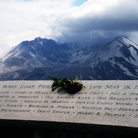
Memorial for the Victims of the EruptionThis is a memorial dedicated to all of the victims of the Mount Saint Helens eruption. It lists all of their names and is located at Johnston Ridge.
|
|
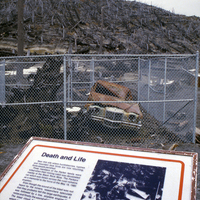
The Parker Family MemorialA memorial sign near the wreckage of the Parker Family's 1972 Pontiac Grand Prix. It is near "National Forest Road 99 at the intersection of NFR 26"
|
|
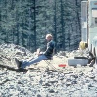
Photo of David Johnston at Coldwater II"David Johnston at Coldwater II, 1900 hours, May 17, 1980. Dave did not survive the next day's eruption. Coldwater II would eventually be re-named 'Johnston Ridge' in honor of Dave."
|
|
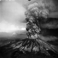
The eruption of Mount St. Helens"Plinian eruption column from May 18, 1980 Mount St. Helens. Aerial view from the Southwest."
|
|
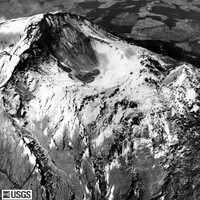
"Bulge and small crater, Mount St. Helens summit""Bulge (right) and small crater, Mount St. Helens summit. Crater area dropped in relation to the summit, and bulge shows pronounced fracturing because of its increased expansion. View looking south."
|
|
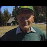
KATU News Segment about Harry R TrumanThis is a recording of the KATU news segment about the death of President Harry R. Truman during the eruption of Mount Saint Helens.
|
|
"Aerial Footage"This is aerial footage of the eruption from a KATU helicopter.
|
|
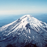
"Mount St. Helens, aerial photograph taken from NE. Sep. 1964.""Mount St. Helens, aerial photograph taken from the northeast. September 1964."
|
|
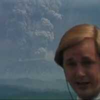
Reporting From a DistanceThis is a video from the Portland, Oregon news channel KATU, displaying the eruption of Mount Saint Helens on May 18, 1980
|
|
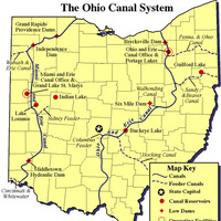
The Ohio Canal SystemA clearer image of Ohio Canals
|
|
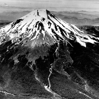
"Mount St. Helens prior to the catastrophic eruption""Mount St. Helens prior to the catastrophic eruption of May 18, 1980. Streams and lava flows also visible. View is looking southerly from oblique aerial view. Mount Hood in distance."
|
|
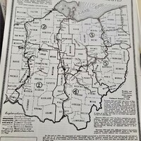
Existing, Abandoned, and Proposed Canals (1935)An Ohio map from 1935 that provides the locations of existing, abandoned, and proposed canals. Photograph taken with the permission of the Paulding County Historical Society.
|
|
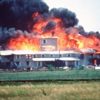
Mt. CarmelMt Carmel sight on fire
|
|
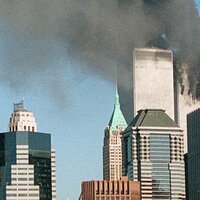
The second planeThe second plane that collided with the south tower. 9:03am
|
|
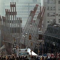
911: Ground Zero, 09/14/2001http://arcweb.archives.gov/arc/action/ExternalIdSearch?id=5997300
|
|
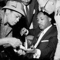
Dr. Martin Luther King stabbingOn Sept. 20, 1958 in side a Harlem department store Dr. Martin Luther King sites with a knife handle sticking out of his chaste.
|

|
Relational Gestalt Group Therapy for Adolescents |
|
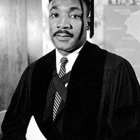
Dr. Martin Luther King Jr. graduation photo.Doctor Martin Luther King junior received his doctorate degree with honors graduation photo.
|
|
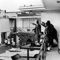
Lorraine MotelLorraine Motel balcony view as civil rights leaders survey the area
|
|
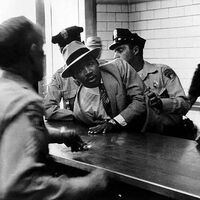
Martin Luther King Jr.’s arrest in Fulton CountyOn Oct. 19, 1960, dozens of young protesters were arrested in downtown Atlanta for participating in a sit-in demonstration at Rich’s department store, setting off a series of historic events.
|
|
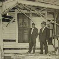
Dr. Martin Luther King Montgomery homeDr. Martin Luther King Montgomery home after a white supremacist bombing
|

|
Science Fair Participation and Understanding of the Nature of Scientific Inquiry |

|
Are Families Falling off the Edge into Poverty? |
|
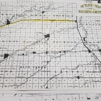
1892 Paulding County Canal MapMap of Paulding County in 1892. The Wabash-Erie Canal is highlighted in yellow, while the Miami-Erie Canal is bolded on the right. Photo taken at the Paulding County Historical Society.
|

|
Pride Parade: Dublin 2019Pride parade in Dublin in 2019. People holding a banner that says "Remember Stonewall"
|
Purdue University College of Liberal Arts